 |
||||||

|
Welcome to the Winter 2014 Newsletter from the Kent Archaeological Field School
3rd-12th April. The Roman Villa at Teston: A classic Roman villa dig with a twist, as well as excavating and mapping the main villa we will be investigating the surrounding Roman landscape. Excavation by the Kent Archaeological Field School over the Easter and May Bank holidays in recent seasons has solved an archaeological mystery that that had eluded archaeologists for the last 100 years. 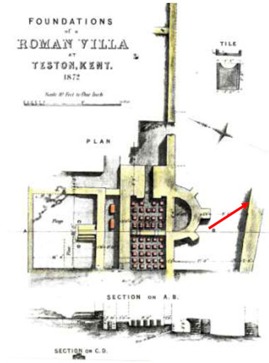 Figure 1. Teston Roman villa showing wall exposed in 2014 (See Fig 2) Fremling found in his hop gardens the remains of a Roman bath house (Fig, 1) and the find was described as being ‘about four English miles from Maidstone, on the left side of the river, are to be seen the remains of a villa.............the situation is pleasant, and as is usual in Roman sites, well chosen, being on a crest of a gently sloping valley looking over the river [Medway]’ . In October 1991 Canterbury Archaeological Trust were called to a site in Teston, just west of Maidstone to investigate Roman remains uncovered by Southern Water whilst constructing a new sewer. It became apparent that a Roman building had been impacted on and CAT’s work uncovered walls that had been robbed out. Later in the 20th century the Maidstone Archaeological Group investigated the site but could not find the 19th century bath house discovery. Last year a geophysical survey took place down slope from the CAT discoveries and possible masonry walls identified. Subsequently the Kent Archaeological Field School were invited by the owner to investigate the site and a field walking weekend in March identified an area of disturbed Roman masonry below that of the CAT discovery and above that of the geophysical survey. Hand digging of test pits identified a substantial deposit of Roman building material and on opening up the trench the south wall stretching for 39m was exposed and running east-west, At each end substantial towers or pavilions were also exposed. Rooms with hypocaust heating were exposed to the north and stretching into the adjoining field and towards CATs investigations in 1991. Marble tessarae from a mosaic pavement were found in the hypocausts along with copious amounts of painted plaster and window glass. The location of the 1872 discovery was identified and is situated in the north-west area of the villa (see above plan). It seems the villa developed over the four centuries of Roman government and although we have identified the main part of the villa there is still areas of the site which may have additional buildings. 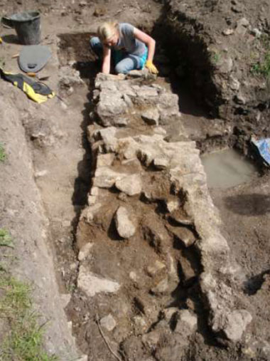 Figure 2. Roman villa at Teston Decorated Samian ware sherds date the construction of the towers or pavilions to the 2nd century AD whilst North Thameside ware dated= the main range to late 1st century AD, whilst coins recovered from the site range from Nerva (96-98AD) to Honorius (393-423AD). Anglo Saxon pottery found adjacent to the main range show occupation in the 7th century AD. Situated in the upper reaches of the River Medway valley with water connections to Rochester and London in a setting which is Arcadian the villa estate would have been the centre of a burgeoning enterprise with the opportunity to exploit the natural resources of woodland, Kentish rag stone and first class grazing for herds and flocks. It is also within a day’s journey by water to London and we know from Pliny and Ausonius the preoccupation of the Roman landed gentry with the Arcadian delights of the countryside. Roman Italy-excavate Nero’s Roman Palace at Oplontis next to Pompeii An unforgettable experience of having exclusive access to the World Heritage Site of Pompeii. Dates are from 1st June to 14th June. Places are restricted so book early. 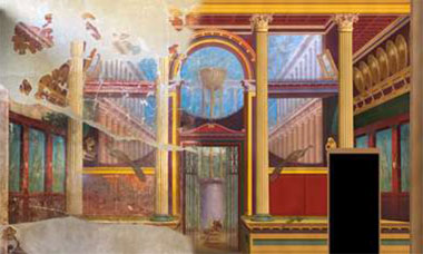 The Oplontis Project began in 2006 with the study of the site known as Oplontis situated at Torre Annunziata, Italy. The work is sponsored by the Centre for the Study of Ancient Italy at the University of Texas in Austin. Its two directors are John R. Clarke and Michael L. Thomas. In addition Paul Wilkinson and the Kent Archaeological Field School, Faversham, Kent have been excavating every year since 2006. Investigation of Prehistoric remains at Hollingbourne A week of excavation of Prehistoric features in the landscape building on our recent work on Bronze Age round barrows and a prehistoric henge. Dates are 4th July to 11th July. 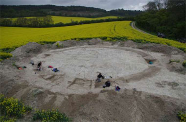 Figure 4. Bronze Age barrows at Hollingbourne There are just a few henges discovered in the south-east of England, and they seem to be a feature of Wessex Downs and not the South or North Downs. The enclosure is adjacent to the Greenway, a path thought to date from the Neolithic and close to another prehistoric path, the Pilgrims Way. The outer rectangular enclosure, dated to the Early Iron Age faces the Greenway path and the site itself is situated on top of a hill surrounded on three sides by water and on its fourth by the Greenway. The site was identified by the uneven growth of crops and field-walking by the school earlier in the year retrieved prehistoric and Saxon pottery from the area. Additional field-walking to the west of this feature identified the site of three ring barrows which had been plotted on Google Earth. In 2013 we investigated Barrow 3 (above) which had a cobbled entrance on the south side delinated by two post-holes either side of the entrance and two adjacent baby burials. We found no other burials within this ring barrow. The artefacts retrieved have been dated to Late Neolithic - Early Bronze Age (see Appendix). This year (2014) we investigated the remaining barrow situated to the south-west of Barrow 1. The North Downs ridge to the east of the Medway seems on initial survey results to have a plethora of ring barrows. The Medway valley, between Maidstone and Rochester has the famous megalithic long barrows clustered in two groups on either side of the valley, which have long been known (Holgate 1981). Now, with the recent discovery of a large Neolithic rectangular timber building at White Horse Stone not far from the Lower Kits Coty burial chamber, the identification of a possible new causewayed camp at Burham (Dyson, Shand and Stevens 2000; Oswald et al. 2001), along with the circular enclosure at Holborough, this region stands out as a potentially important ritual Neolithic and Early Bronze Age landscape which is in need of extensive, detailed modern study. The Roman Bath-house and Estate at Abbey Fields, Faversham 25th July to 14th August. A Roman building which is beginning to reveal its secrets. This is an ideal training ground for budding archaeologists. 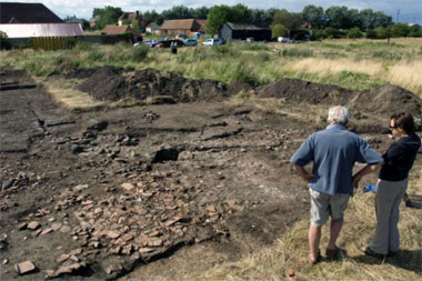 Figure 3. Roman walls under ceramic roof tiles just under the turf The newly discovered building was investigated initially in 2011 by over 50 students who attended the field school training week in August, and for them it was a unique experience on seeing how an investigation of an important Roman building was undertaken. On-going work in 2013 has shown that the survival of the building was amazing with stone walls, opus signinum floors (polished terracotta floors), under floor hypocaust heating, all untouched, and covered by tons of ceramic roof tiles and the collapsed stone walls covering huge amounts of box flue tiles which were used to direct hot air up the interior walls. Painted plaster from these walls is mostly white but the hot sauna room on the north side of the building had plaster walls decorated in green, red and yellow panels. Outside the north wall recent work has shown that the tidal waters of the Swale estuary lapped the building and investigation has shown a large tidal inlet existed here in the Roman period, and was deep enough to form a harbour for Roman ships. The Roman building itself has a coin and pottery range from the 2nd to the late 4th century and numerous Roman domestic articles were also recovered including Anglo-Saxon silver jewellery, bone hair pins and the remains of exotic glass vessels. The building is huge, 45m long and 15.40m wide, which is about 50 Roman feet wide. The outside walls were built of mortared Kentish ragstone and flint nodules with the collapsed walls indicating a height of about 3m for the outer walls. Levelling courses of Roman tile were also a feature of the walls. Large quantities of window glass have also been retrieved. Investigation has unravelled some of the mystery of the buildings function and this work is still on-going. Excavation has shown the building was originally built in the early 2nd century AD as an aisled barn with a mortar and chalk floor. Forensic investigation has revealed the remains of the stalls used to contain the Roman estate farm animals. Very soon after, the building was rebuilt as a huge bath house with hot apsed rooms, steam rooms, and warm rooms used for massage. The decoration has a feel of a municipal baths with none of the luxurious features one would expect of a private enterprise bath house. Given the size of the bath house it is far too large for a Roman villa estate and must have catered for another set of clientele. It is probably too far from the main Roman road to London (Watling Street) to have been an Imperial posting house with hotel but it sits astride the port of Faversham and may have catered for the crews of visiting ships. Field walking has indicated there are other Roman buildings alongside the inlet, itself a fresh water river at low tide and future investigation including geophysical survey will be focused on their chronology and function. The site itself is rich in archaeological remains with the Roman villa discovered in 1960 close by, which itself was built on a Late Iron Age farm. In the medieval period Faversham Abbey was founded on the site and two magnificent tithe barns still stand between the two Roman buildings. Excavation on site is 25th July to August 14th. The training week runs from August 3rd to 9th, and is held in the mornings at the Field School and in the afternoons on site. Hours are 10am to 4.30pm for the duration of the dig. Please ensure you have gloves, sun cream, lunch and water. To contact the Site Director-Paul Wilkinson please phone 07885 700 112 or email info@swatarchaeology A new book from Paul Wilkinson The Archaeological Guide to Pompeii will be published by Taurus Books in 2016 Take advantage of Dr Paul Wilkinson’s expertise by joining him on a week’s tour of Pompeii and the Bay of Naples in September. An excerpt from the forthcoming book is of the House of the Faun. Named after the bronze figure of the Dancing Faun (which in fact is a Satyr) found on the side of the impluvium in the main atrium, it is the largest house in Pompeii and occupying an entire insula. Originally built during the Samnite period (second century BC) it shows elements of Hellenistic influence in its layout of two atria, a peristyle and a spacious hortus (garden), which later was converted to a second peristyle. The entrance on the left leads to the public area of the house through the massive triple door. On the mosaic ‘doormat’ is the Latin welcome HAVE. The fauces have two public larivia (household shrines), elaborately decorated in stucco high on the walls. The flooring comprises triangular pieces of coloured marble (opus sectile) embellished on the threshold with a wonderful mosaic of actors’ masks, garlands of flowers and fruit. It is now on display in the Naples Archaeological Museum. The front of the house is organised around two atria courts. Either side are cubiculi used as guest bedrooms or for private meetings with clients. On the far side is one of the most important rooms in the house, the tablinum, used for the receiving of clients and guests by the seated patron. Either side of the tablinum can be found two rooms possibly used as winter and summer dining rooms. Walk through the atrium and you are in the first of the peristyles with a portico of twenty-eight ionic columns and a fountain and basin in the centre of the hortus (garden). The walls of the peristyle would have been covered with decorative stucco and paintings. The open room (exedra) in the centre of the rear wall of the peristyle is framed by two highly decorated Corinthian columns. The floor was covered by the famous Alexander Mosaic now in the Naples Museum along with mosaic scenes of the Nile from the threshold of the room. On either side of the Alexander Mosaic room are two summer dining rooms facing into the wonderful garden of the second, larger peristyle garden with a Doric portico. On the far side of this larger, more private, peristyle garden is a small postern gate reserved exclusively for the family. On the east side of the house is a service corridor isolating the kitchen, baths and slaves quarters. 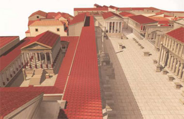 Figure 4. The Roman Forum at Pompeii as seen through the eyes of virtual reality The enigma of Stonehenge continues to fascinate join us in June 2015 on an exclusive visit inside the stone circle to watch the sunrise. See www.kafs.co.uk for further details. A hidden complex of archaeological monuments has been discovered around Stonehenge, showing that it was at the centre of a series of ancient ritualistic structures. The finds, dating back 6,000 years, include 17 previously unknown wooden or stone structures, as well as dozens of burial mounds. They were located using underground scanning technology. Most of the monuments are merged into the landscape and invisible to the untrained eye. The four-year study, the largest geophysical survey undertaken, covered an area of five square miles and penetrated to a depth of three metres. 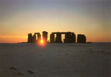 Figure 5. Sunrise at Stonehenge Prof Gaffney said the new work showed that Stonehenge was not an isolated structure on the edge of Salisbury Plain, but the centre of a widespread arrangement of ritualistic monuments. "You've got Stonehenge which is clearly a very large ritual structure which is attracting people from large parts of the country," he said. "But around it people are creating their own shrines and temples. We can see the whole landscape is being used in very complex ways." Operation Stonehenge was televised: What Lies Beneath (BBC Two), which set out to explain new research that could "finally unlock" the story of the enigmatic monument. The two-partner followed the work of Prof Gaffney and the Hidden Landscapes Project, a team of archaeologists who have spent five years using ground-penetrating radar to scan the ground around the monument. The concluding episode asked what their discoveries could tell us about who built Stonehenge and why. First, though, we were subjected to an array of baffling graphics that added little to our understanding. True, the research itself had involved sophisticated scanning techniques, but the resulting scans were presumably deemed too boring because they were sidelined in favour of computer generated scrawls of surrounding monuments and the route the stones took across the country. A new sketch appeared on screen every couple of minutes, with an infuriating "ping". Superimposing flashing maps and spinning arrows over video of fusty historians in tweed jackets just looked silly. At one stage, an archaeologist waved his hands up and down as a computer generated building was constructed around him. Later, a "land artist" sketched out how each stone interlocked - by raking sand into a replica on a beach. Cue yet more graphics. It was as if the producer of Spooks had taken over Time Team for a day. This was a shame, because the research was fascinating. In fact, it was on much safer ground when it stuck to more typical Time Team fare, such as when an "experimental archaeologist" did a very low-tech experiment with the same stones used at Stonehenge to discover that it would have taken a team of 10 stonemasons a decade to carve the intricate grooves into the stones that made them fit together. Best of all, archaeologist Jacqueline McKinley analysed a skeleton buried in a ditch to discover the man was shot repeatedly with flint arrows, suggesting human sacrifice. We needed much more of this and much less theatrics. Tom Rowley Music to their ears: A new theory by Steven Waller believes that the stone circles of Stonehenge were designed with acoustic properties in mind Animals depicted running along the walls of the Lascaux caves in France are among the most magnificent examples of prehistoric art discovered. But rather than depicting Palaeolithic hunting scenes, new evidence suggests that the images may represent the eerie sounds that emanated from the mouths of the caves. Steven Waller, an American researcher, believes that the echoes of ritual clapping outside the cave would have sounded like herds of hoofed animals running. He proposes that ancient sacred sites, including Stonehenge, were built for their acoustic properties, which prehistoric people mistook for supernatural noises. Sound illusions may explain why prehistoric people chose to decorate caves with paintings, in the belief that they were inhabited by spirits, he said. "Ancient mythology explained echoes from the mouths of caves as replies from spirits, so our ancestors may have made cave paintings in response to these echoes and their belief that echo spirits inhabited rocky places such as caves or canyons," added Mr Waller, author of the Rock Art Acoustics website. Echoes of clapping can sound similar to hoof beats, and multiple echoes within a cavern can blur together into a thunderous reverberation that mimics the sound of a stampeding herd, he said. "Many ancient cultures attributed thunder in the sky to 'hoofed thunder gods', so it makes sense that the reverberation within the caves was interpreted as thunder, and inspired paintings of those same hoofed thunder gods on cave walls," he said. "This theory is supported by acoustic measurements, which show statistically significant correspondence between the rock art sites and locations with the strongest sound reflection." In the case of Stonehenge, Mr Waller's research suggests that its architects may have been trying to recreate a sound effect made during ritual dancing. People taking part in a ritual blindfolded dance around a pair of pipers would have heard the music grow quieter as they moved past certain spots due to a natural phenomenon known as an "interference pattern", he said. Mr Waller believes that the ritual, and its effects, became so important to Neolithic Britons that they attempted to capture it in stone. "My theory that musical interference patterns served as blueprints for megalithic stone circles - many of which are called Pipers' Stones - is supported by ancient legends of two magic pipers who enticed maidens to dance in a circle and turned them all into stones," he said. The theory contradicts the most widely accepted suggestion that the stones were built to line up with the rising or setting sun on the summer and winter solstices. Mr Waller noticed a resemblance between an interference pattern and the arrangement of stones at Stonehenge, so he set up a test in a field using two flutes playing the same note. At certain angles the pitch of one flute drowned out the other and "gave blindfolded subjects the illusion of a giant ring of rocks or 'pillars' casting acoustic shadows", he said. However, Mike Pitts, the editor of British Archaeology and a leading expert on Stonehenge, said ‘there was no question that it was designed to align with the midsummer sunrise and mid- winter sunset’ Sarah Knapton Archaeologists who made what has been described as the most exciting discovery at Stonehenge for 50 years are calling on the government to abandon plans for a tunnel and to build a bypass instead. Plans were announced last month for a 1.8-mile tunnel costing up to £1 billion through the middle of the World Heritage site. The intention was to restore the landscape around the prehistoric monument and to provide greater peace for visitors. The announcement was welcomed by the National Trust and English Heritage, as well as transport groups who claim that delays on the main West Country route cost millions of pounds However, recent discoveries 1.5 miles away at Amesbury, beside the A303, have for the first time shed light on the reason that the monument was built there. A series of digs have uncovered a ritual feasting site, dating back thousands of years before Stonehenge was built, around the edge of a natural spring. Thousands of stone tools have been excavated along with the butchered bones of extinct animals such as aurochs, a giant bull. The tools are said to prove that the spring at Blick Mead had been an important gathering place dating to the end of the last Ice Age, more than 9,500 years ago. David Jacques, the archaeologist from the University of Buckingham who made the discovery, said: "This is the only untouched Mesolithic landscape we are aware of in the country. It has been preserved perfectly due to a sequence of accidents of history and prehistory. If this tunnel goes ahead it could wreck the only chance we currently have to learn about how Mesolithic people lived in the cradle of Stonehenge." The find connected the early hunter gatherer groups returning to Britain after the Ice Age to the beginning of Stonehenge in 7500BC, he said. "The site is the repository of the earliest British stories, connecting a time when the country was joined to the mainland of Europe to it becoming the British Isles for the first time." Mr Jacques said. Tim Darvill, of Bournemouth University, has described Blick Mead as the most important discovery at Stonehenge in more than 60 years. The archaeologists fear that the excavations and slip roads required for the tunnel will destroy the site. They also doubt that it will cure tailbacks and congestion on the A303. Andy Rhind-Tutt, chairman of the Amesbury Museum and Heritage Trust, said: "The current tailback can extend five miles and can take two hours to get through. Any tunnel would need to be motorway standard, and even with four lanes there would still be tailbacks." He said that concerns had been raised about the water table. The chalkland landscape would mean that the tunnel would effectively become a dam, which would change the water course. "Kilometres of chalk would have to be extracted," Mr Rhind-Tutt added. "Air conditioning, water pumps, lighting and maintenance costs would be colossal. A much more practical solution would be to reroute the A303 supporting South Wiltshire as well as the West Country." Simon de Bruxelles Long Barrow burials 2014 style Tim Daw has built a long barrow in a Wiltshire field and is looking for (dead) customers You enter, stooping, through a low stone archway, and all of a sudden you are in a different world. The weak afternoon sun lights up the central passageway, on either side of which stand beehive shaped chambers alive with flickering candles. The walls are made of solid rocks and stones held together by their own weight. Welcome to the Long Barrow, a 75ft-long (23m) burial mound built not 6,000 years ago but earlier this year in a field in Wiltshire. Outside, a chill wind is whipping across the countryside, and the leaves of the local crops are flapping wildly to and fro. In the fields, the earth is wet and muddy, but inside the Long Barrow the stones on the floor are white and dry. Overhead is a vast, insulating, protective canopy of earth and chalk, which means that down here everything is cool, calm, dark and quiet as befits a final resting place. To date, there are only two sets of human ashes inside, but there is room for many more urns. It's a nondenominational place of interment, open to people of all and no faiths. 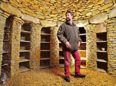 The Long Barrow is the idea of local farmer Tim Daw, on whose land it stands, in the undulating Marlborough Downs. " I work part-time as a steward at Stonehenge, and I've always thought I would like to build something Neolithic: a mixture of ancient and modern," says Daw, who worked in information technology for 10 years before turning his hand to farming. " I got the idea from meeting people who had nowhere to put the ashes of their friends and family, who didn't want to leave them in some impersonal municipal crematorium. " I remember one woman telling me it felt like she'd lost her father twice – once when he died and then again when she was separated from his ashes. That's when I got the idea for this long barrow; you don't have to have strong beliefs, or any beliefs at all, to have your ashes stored here. You simply don't want them to be buried in a church." For a while, however, the idea remained just something to be talked about at the pub. Then the notion found its way onto social media and a stonemason-cum-builder named Geraint Davies came forward. To Daw's surprise, he offered to build not just the barrow – a whale-shaped hill about 18ft (5.5m) high - but also the burial chambers. The whole job took eight months, and cost £200,000, but the finished structure is a work of beauty. The main supporting blocks are giant lumps of sparkling Gloucester and Sarsen (native to Salisbury) stone, transported here by lorry, and then lifted into place by cranes. By contrast, the chambers are lovely little lung-shaped structures, in which rocks are placed on top of each other and locked together in a stone specially made. It bears the name GRAY, carved in elegant capital letters, beneath the outline of rolling hills (seen in Neolithic times as the breasts of the goddess) and a crescent moon. "We spent a lot of time discussing what the family wanted," says Swiss-born stone carver Lisi Ashbridge, who lives nearby. "The eventual design reflects Carol's love of the surrounding hills, and her interest in symbolism." The images on the sealing stone also bear visual reference to pagan goddesses, but far from encountering bureaucratic or religious resistance to the Long Barrow, Daw says the application to build the structure went through the local planning committee without any opposition. 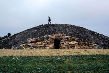 What's more, the barrow has been approved by bodies working for less worldly authorities. It has been declared to be standing directly on a ley line connecting Stonehenge and Avebury. It is also perfectly positioned for the moment on December 21, sort of spherical union. As for the ashes, these are placed on small shelves cum- alcoves, and sealed up with carved stones, held in place by the application of a light layer of lime mortar. And while many of the shelves are for single urns, others are big enough for two; should one partner die, the other partner's ashes will be placed alongside them when their life ends. Unlike conventional venues, the Long Barrow won't be open every day, from nine to five. Instead, people can visit at a pre-arranged time, when the metal gates will be unlocked. The idea, says Daw, is not that he should supervise but rather that people are left alone with their own thoughts. Applications for places in the Long Barrow have begun to come in from all over the country. The first person to have her ashes placed there was Carol Gray, a local woman who died in her early 40s of breast cancer, leaving a husband and two children. Rather than opting for a mass-produced nameplate, her husband, Adrian, decided to have the day of the winter solstice, when the sun will shine even more directly into the barrow than it does at present. In addition, the Arch druid of Avebury has been to inspect the barrow, and left an apple as a blessing. Two months later, it is still as hard as when he left it. It's not just those in positions of responsibility who are intending to visit. Already, the barrow is in demand from people who want their ashes to end up here. The price of a single-niche resting place is £400, going up to £1,200 for a niche that can accommodate spouses and eventually other family members. And what of the owner of the Long Barrow site? Does he intend to come here eventually? "Oh, yes," says Daw, smiling. "I've reserved a little place for myself. Right up at the far end." Christopher Middleton To inquire about a place in the Lonq Barrow, visit the website thelonqbarrow.com. To see more of stone carver Lisi Ashbridqe's work, visit itswritteninstone.co.uk Metal Detectorists- good or bad thing? Read what the press are saying: Britain’s understanding of its history has been transformed by the change in the law that allowed treasure hunters to profit from their bounty, according to the head of the British Museum. The Treasury Act of 1996 made it an offence to keep discoveries secret but, crucially, allowed metal detectorists to sell their finds and share the profits with the landowner.  he introduction of the act has stopped artefacts from disappearing on to the black market. Neil MacGregor said: "The success of the portable antiquities scheme cannot be overestimated in terms of our understanding of our past. The variety and diversity of finds is extraordinary." Yesterday the museum unveiled the millionth find under the scheme: 22,000 Roman coins found in a field in Devon. When the treasure hunter Laurence Egerton, (left), discovered the hoard, he was so excited that he watched over the discovery for three nights in his car before archaeologists arrived. Mr Egerton had been out with his metal detector in east Devon when the machine gave a high-pitched beep. He found two coins, both the size of a thumb nail, and began digging with his shovel, whereupon "thousands spilled up on to the field". "I had no idea how far down the coins went so I stopped immediately and phoned my wife to come to the site with a camera," he said. "Between finding the hoard and the archaeologists excavating the site, I slept alongside it in my car for three nights." Mr Egerton, a semi-retired builder, said that he did not want to leave the coins unguarded in case a passer-by made off with them. The "Seaton Down Hoard" of copper-alloy coins is one of the largest and best preserved 4th-century collections to have been found in Britain. It pales in comparison only with the 52,500 coins discovered by a hospital chef, also using a metal detector, in Frome, Somerset, in 2010. "It's by far the biggest find I have ever had," Mr Egerton said. "It really doesn't get any better than that. It is so important to record all of these finds properly because it is so easy to lose important insights into our history. It's very unusual to get Roman artefacts down this way as historians don't think there were many of them around." The coins, which together weigh 68kg, were minted between AD330 and AD341, when the first Christian ruler, Constantine the Great, transferred the imperial capital from Rome to Byzantium, later renamed Constantinople and now Istanbul. Bill Horner, an archaeologist at Devon county council, said: "The coins were in remarkably good condition. Coming out of the ground, you could see the portrait faces, a family tree of the House of Constantine." The hoard was found near an excavated Roman villa in Honey ditches last November. Experts believe that the coins were buried by a soldier for safe keeping. The Royal Albert Memorial Museum in Exeter, which already houses a large collection of Romano-British artefacts, has launched a fundraising campaign to have the coins exhibited there. Georgie Keate Rumblings of alarm have shaken the UK metal detector fraternity with the news that one of their number had been arrested for digging up a medium-sized arsenal of weapons. Rifles, hand grenades, artillery shells and a Vickers machinegun were among the items taken this week from the garage of St Albans fireman Alan Tissington, and exploded by the authorities in a nearby field. The 48-year-old was arrested on suspicion of disinterring these weapons without permission, an event that sent Shockwaves through the nation's detectorist community. The timing couldn't be worse as their niche hobby is about to take the lead role in a new comedy series on BBC4, written by and starring The Office actor Mackenzie Crook. For the wielders of Viking 40s, Fisher 1235Xs and XP Goldmax Powers (all essential equipment for the serious enthusiast), this week has been a time in which to batten down the hatches and keep a low profile. Indeed, so protective are they of their hobby that they have refused to co-operate with the makers of the show, Detectorists. This, despite Crook's claim that the show is "an affectionate look" at – and not a mockery of - the art. "My character, Andy, works part-time for a temping agency, so that he is freed up to do metal-detecting," he explains. "I don't know why it is, but any activity that's not a sport is always portrayed on television as something for sad and lonely people. "What motivates my character is not money. All he wants is to find something that excites the amateur archaeologist within him." However, members of the National Council for Metal Detecting (10,000 and counting) are not convinced. "The way it was put to us, it was something we felt we did not want to be involved with," says Trevor Austin, the NCMD's general secretary. What makes the, metal-folk nervous is the suspicion that they are going to be portrayed as spineless, antisocial anoraks. Indeed, detecting does not tend to be classified as one of the hipper hobbies, ranking lower even than train spotting, scrapbooking and philately. But this is a myth that needs exploding, insists David Lascelles, who runs the Pinpointer Detector Group, based in Lincolnshire. "The great thing is you never know what you're going to find," he says. "In 35 years, I've unearthed an Iron Age silver brooch dated around 100 BC and some Celtic cloak fasteners. But the find that brought me the most pleasure was when I was called in by the coastguard to help a woman on the beach who had lost her engagement ring. "Things didn't look very promising, because I kept finding nuts and bolts and bits of silver paper. All of a sudden, I got a really strong beep-beep signal, and there it was - an 18-carat gold ring with four diamonds. "Every year, on the anniversary of that day, the lady sends me an email, thanking me." Though invaluable to the ring-loser, that find would not have counted as "treasure" under the strict code observed by hobbyists. According to a 1996 Act, it must be more than 300 years old and made of gold or silver, or dating back to the Bronze Age or beyond. Unlike buccaneering pirates, detectorists are not allowed to stuff items down their boots without declaring their find; failure to do so can result in a fine or three months' prison. In fact, on coming across anything remotely treasure like, finders are legally required to inform the local coroner within 14 days. If the piece is indeed a ninth-century bracelet rather than a 21st-century fairground prize, it will be scrutinised by the Treasure Valuation Council (TVC). However, this doesn't guarantee anyone a fortune: of the 1,000 items submitted per year, 500 are returned to the finder and landowner, having been valued at less than £200. On the other side of the coin, if a museum wants to buy the piece, the TVC establishes a fair price, which is then split between the finder and the landowner. Which, of course, means detectorists have to secure permission from the person whose land they are going to search, before even warming up their batteries. There is, however, lurking within the ranks of the detectorists a rebellious faction known as "nighthawks". "These are sophisticated gangs who travel as far as 200 miles to dig up land," says Mark Harrison, crime and policing officer for English Heritage. "They strike at night, wear camouflage and dig land designated as not to be disturbed: say, the site of a Roman villa, known to be buried beneath the surface of the earth. "If caught, they will be charged with a criminal offence. After all, they are not just stealing from the landowner, but from the nation." Something for every amateur gold-digger to bear in mind. Christopher Middleton Rules for metal-detecting are at www.finds.org.uk. For information on the National Council for Metal Detecting visit www.ncmd.co.uk What’s the difference between a metal detector and a metal detectorist? Don’t worry if you don’t know the answer – you might be laughed out of your local metal detecting club but it certainly won’t stop you enjoying this warm new sitcom. Detectorists – these are the practitioners, by the way; detectors are their tools – has been criminally buried on BBC Four but it is no rusty ring pull or discarded aluminium biscuit wrapper. On the contrary, this is quite a find – a treasure chest of first-rate writing, clever jokes and likeable performances. Written by and starring Mackenzie Crook, it follows the mundane lives of the quiet, retiring Andy (Crook) and the bumptious, wise-cracking Lance (played by the ever impressive Toby Jones). These two eccentric metal detectorists spend their days plodding along ploughed tracks, hoping to disturb the tedium by unearthing a fortune. While valuable coins and ancient weapons eluded the pair last night, they did happen upon an attractive university history student called Sophie (Aimee-Ffion Edwards), who was keen to find out more about the local history of the area. Predictably, she was more intriguing to them than any Saxon artefacts buried in the dirt. And this is the crux of Detectorists. Andy and Lance are, of course, looking for something much more than scraps of metal in the ground – they are looking for something to ignite and improve the drudgery of life. 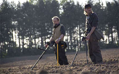 Lance is struggling to deal with the loss of his wife to some great hunk of a man, while Andy’s relationship with his girlfriend Becky (Rachael Stirling) is clearly strained, a point highlighted by his interest in Sophie. Their hobby provides the comic ammunition – without irony, Andy described the people who buy Lance’s worthless finds as “sad gits”, while one superb set piece saw Lance confuse the watermark on Google Earth with an Iron Age settlement. But this is really a programme about companionship. Lance and Andy bicker constantly and re-tell the same jokes but, just like Fletch and Mackay in Porridge or Albert and Harold in Steptoe and Son, the pair couldn’t survive without each other. It is a classic sitcom set-up which has been executed well here. There was something both pathetic and touching about the two of them sharing a miserable-looking curry before heading up to the metal detecting club to hear a talk about buttons. “I think I’ll give that a miss,” sneered Lance earlier in the episode but he knew, and we knew, that he’d be there. What else was there to do, after all? Having gained permission from a mad old farmer at the conclusion of the episode to scour some promising-looking land, Andy and Lance started to believe that this could be their moment – but yet again the hapless duo uncovered nothing but rubbish. No matter, viewers have already struck gold. Rupert Hawksley Watch a clip from the programme here - http://www.bbc.co.uk/programmes/b04jy45z One of the most important ‘finds’ by detectorists has to be the Staffordshire Hoard as reported by David Wilkes: ‘It was the find of a lifetime and made them both millionaires. But when jobless Terry Herbert discovered the largest hoard of Anglo-Saxon treasure in history in farmer Fred Johnson’s muddy field, it also sparked extraordinary tensions between the two men. Now, despite each receiving an equal share of the money from the £3.3million treasure, their relationship has soured so badly that Mr Johnson, 67, has banned Mr Herbert, 56, from his farm. Both men have also spoken of their regrets at making the find. The rift began when Mr Herbert revealed a desire to search for more treasure on Mr Johnson’s land. Reacting with fury, the farmer said: ‘I wish I’d never met the man. It has caused me nothing but bother, all this. ‘I never want to see that fellow on my land ever again. To be honest, I got fed up with him from the start. I was fed up of his greed. ‘From the moment he found the hoard all he wanted to talk about was how much money we were going to get for it and that, no matter what we do, we shouldn’t accept the first offer. I couldn’t have cared less.’ It was 18 months ago that Mr Herbert’s find on Mr Johnson’s land in Brownhills, Staffordshire, was announced. The 1,300-year-old haul included beautiful gold sword hilts, jewels from Sri Lanka, exquisitely carved helmet decorations and early Christian crosses. Within days former coffin factory worker Mr Herbert, using an 18-year-old metal detector that cost £2.50, had filled 244 bags, including gold objects alone weighing more than 11lb. Archaeologists believe the loot was buried at the site by a king or warlord who was killed before being able to retrieve it. Mr Johnson said at the time that he was ‘not happy’ with Mr Herbert because they had ‘agreed to keep it all low-key’, adding: ‘It is not about the money for me, it’s an incredible find for the country and that’s what is more important.’ 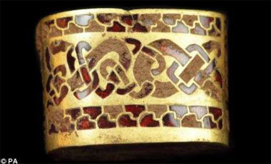 The Staffordshire Hoard was valued by the independent Treasure Valuation Committee at the British Museum and purchased by the Birmingham Museum and Art Gallery and the Potteries Museum and Art Gallery. Mr Johnson and Mr Herbert received their shares of the money at the end of 2009. Mr Johnson is building a new house on his farm while Mr Herbert has moved from his council flat in Burntwood, Staffordshire, to a luxurious bungalow nearby. 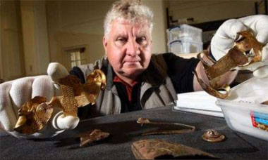 But despite apparently having much to be grateful for, the simmering ill-feeling between the two has erupted into an all-out slanging match. Yesterday, Mr Johnson said: ‘It’s not like we were ever friends anyway. ‘He was just very persistent so I let him on my land. ‘Sometimes I just wish one of the poor veterinary students had found it instead, because it would have set them up for life rather than me.’ 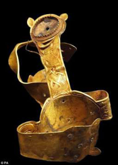 Mr Herbert responded by claiming Mr Johnson was unhappy that he was forced to split the cash. He said: ‘I think Fred wanted all of the money and is now resentful he has had to share it. ‘He’s acting like a child and cutting his nose off to spite his face. ‘It does hurt my feelings that he has taken this stance. ‘Now, I’m not sure there is anything we can do to patch things up. Sometimes I wish I’d never found that hoard.’ He claimed that five years before he dug on the field where he found the hoard, he was ‘warned off’ and told Mr Johnson ‘would want all of anything that was found’. ‘But when I eventually went on there and found the hoard, Fred could not have been less interested at first,’ he said. ‘Fred wanted everything kept quiet at first, even though I told him it was not realistic. ‘But the next minute he is all over the TV, so I decided to let him have all the glory in the end. He has always had a bad attitude and this just sums him up, I’m afraid.’ But out of strife and discord the Staffordshire Hoard still has its surprises as reported by Jack Malvern. ‘Wily Anglo-Saxon goldsmiths have been unmasked as master fraudsters who deceived kings, warriors and even today's historians with an ancient technique. The Dark Age metalworkers made items of jewellery appear more pure than they were by using acid to remove other metals from a natural gold alloy known as electrum, leaving a thin layer of near pure gold on the surface. The technique, known as depletion gilding, not only fooled the buyers but also modern museums, which have been using a flawed method of measuring gold purity. Sword decorations and jewellery thought to be 75 per cent gold have been found to be 84 per cent (20 carat) gold on the surface but only 70 per cent (17 carat) beneath. The remainder is silver and copper. A British Museum study of 140 items held in collections suggests that women's jewellery was less important than men's adornments because it was made of the poorest gold — a fact hidden by the way the surface was treated. The objects retain their value because of their historical significance, but curators said that the Anglo- Saxon buyers probably did not know that their gold was up to 50 per cent silver. Eleanor Blakelock, the British Museum scientist who made the discovery, was allowed to scrape tiny cores of metal from the Staffordshire Hoard in Birmingham Museums (which co-owns the hoard with the Potteries Museum), and from Anglo- Saxon gold in the British Museum's own collection. Analysis with a scanning electron microscope showed that the further she probed beneath the surface, the less pure the gold. She said that the goldsmiths' technique was "a bit of a cheat" and the absence of written records implied that it was a secret of the trade, passed from father to son. "We were able to show it was a widespread activity, happening on practically all the sheets [of gold]," she said. "This is the first time we have found them doing it in the Anglo-Saxon period. I suspect that the Romans were doing it too. I suspect that everyone was doing it." The earliest evidence for the technique was found in a 5,000-year-old pot in Ur, southern Iraq. However, it was not believed to be in common use. Speaking at Birmingham Museums, which today opens a new gallery to display the Staffordshire Hoard, she said: "I was absolutely petrified to be scraping objects from here and the Sutton Hoo treasures. I had to go and have a sit down in the cafeteria afterwards”. Voyages of discovery crossing the oceans with intrepid explorers  A small metal panel found on an uninhabited Pacific atoll belongs to the aircraft that Amelia Earhart was flying when she vanished 77 years ago, it has been claimed. The riveted aluminium plate- may be the first wreckage uncovered since the American aviator's disappearance in 1937 while attempting to become the first woman to fly around the world. She was an accomplished flyer who in 1932 became the first woman to make a solo flight across' the Atlantic. Her exploits brought her global fame before her disappearance at the age of 39. The roughly 3ft sq battered metal panel was found on a beach in 1991 by a group of American aviation archaeologists searching for Earhart's twin-engine Lockheed Electra on Gardner Island, now renamed Nikumaroro, part of the Phoenix Islands group in the central Pacific. Nikumaroro is 340 miles (550km) from her intended destination, Howland Island. The International Group for Historic Aircraft Recovery, the Pennsylvania-based group that found the panel and has led the search, said after early tests that it was from an American aircraft, but it could not match the size and rivet patterns to any parts of surviving Lockheed Electra aircraft similar to Earhart's plane. Richard Gillespie, the director of the group's Amelia Earhart project, said: "We knew it was part of an airplane and we suspected it was part of Earhart's airplane, but there's no place it matches." It was only much more recently that the researchers realised that Earhart's aircraft had been modified just before she began her around-the-world attempt, with a fuselage window having been covered over with an aluminium panel. They have now established that the panel found on Nikumaroro Island matched the dimensions and rivet pattern that would have been needed to cover the window on Earhart's aircraft. "The patch was as unique to her particular plane as a fingerprint is to an individual," Mr Gillespie said. The group plans to return to Nukumaroro next year with a remote operated underwater search vehicle to search for more remains of the aircraft. Contractors hired by the group in 2012 captured sonar images off the west of the island that appear to match the size and shape of the lost Lockheed Electra. An unresolved question is whether Earhart and Fred Noonan, her navigator, survived if they did ditch their plane near Nikumaroro. In 1940, Gerald Gallagher, a British colonial officer and pilot, found a skeleton that he believed to be that of a woman on the island under a tree, near an old sextant box. He was ordered to send the remains to Fiji. They were lost long ago. Voyages of Discovery - Norman Hammond writes: ‘The recent call by President Xi of China's for "a 21st-century maritime silk road"—signalling China's commercial expansion into the Indian Ocean — recalled an age when seaborne links between China, Africa and the countries around the Arabian Sea mirrored the Silk Road. His image of "a string of pearls" ports built with Chinese capital from Tanzania east to Burma reflects the pattern of emporia where Roman, Islamic and Chinese imperial goods traded. A recent article in Science magazine (Sailing Sinbad's Seas, vol. 344) reports how archaeologists are rediscovering this ancient commerce. 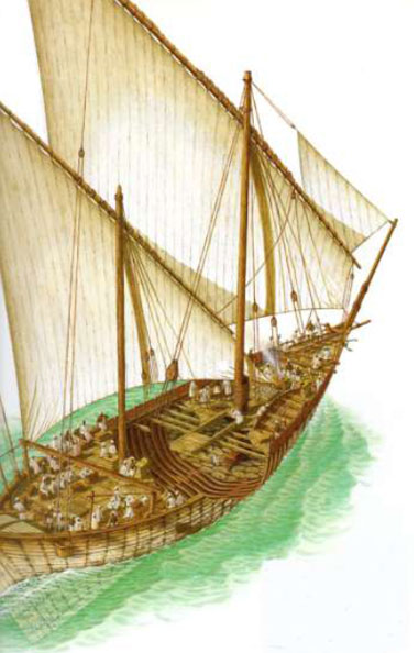 Andrew Lawler cites Sinbad's desire "to visit far countries and strange people, to voyage among the isles... also the trading habit rose in me again". Until recently, "Sinbad's tall tales held little interest" for scholars focused on the overland Silk Road: they forgot that Marco Polo came back by sea, traversing that same Indian Ocean. The ocean's archaeology has been described as that of a ring of coast surrounding a vast sea, scattered with islands. The "ring" is actually a figure-of eight, narrowing where India and Sri Lanka push south. In the 1920s, when the European rulers of Rhodesia disputed claims that the ruins of Great Zimbabwe had been built by Indian Ocean trade was carried by vessels such as the dhow native Bantu, the late Gertrude Caton-Thompson was invited to dig there, and found glass beads and porcelain from China and Persia; at several sites due east on Madagascar, Islamic glass and Chinese pottery have been found from the early second millennium AD. And the nearby Comores have been found to have had ancient contact between the islands and southeast Asia, including Asian genes in the Malagasy population. Indonesian mariners had discovered a "conveyorbelt" current that took them due west towards Africa. African contacts with Arabia and the Persian Gulf began in the seventh century AD, Science reports, through trade in glass beads. By AD 1000 there was contact with Sumatra and India. It was once thought "that Westerners jump-started the Indian Ocean economy", but "Egyptian and Roman merchants were likely drawn to an already booming international trade", Science says. President Xi's ambition reflects a commercial reality that is already many centuries old. Voyages of Discovery - The Edge of the World: How the North Sea made us- Gerard DeGroot on Michael Pye’s new book: 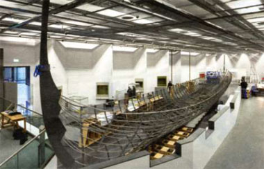 On Mainland, Orkney, there sits a Neolithic cairn called Maeshowe. The Vikings, who visited the island a millennium ago for a spot of pillaging, broke into the cairn and left behind some graffiti. One scribble reads: "Lovely Ingeborg has big boobs", or something like that. That little sentence, and where it was found, tells the historian a lot. We can conclude that the Vikings were curious about their world, otherwise they wouldn't have entered the cairn. They were young and mischievous, but a few could read and write. They shared a fondness for big breasts. In other words, they had a lot in common with us. That commonality figures large in this extraordinary book. Michael Pye's subject is what used to be called the Dark Ages. "The idea of 'darkness' is our mistake," he argues. "What our forefathers lived could better be called the 'long morning' of our world." Pye shows how modernity was forged as the sun rose slowly on the North Sea. "This cold, grey sea in an obscure time made the modern world possible." Back then the sea was a highway. It held dangers, but the perils of travel by land were more threatening. This meant that the world had a different shape to the one it has today. For a trader in Ipswich it was easier to travel to Bergen — 510km by sea — than to York, 340km by .road. The sea was a conduit for commerce, largely free of chauvinism. "It was easy for Scandinavians to be in York, Frisians in Ipswich, Saxons in London, and the fact was so unremarkable that it is hardly recorded." Pye starts with the Frisians, whose flatbottomed boats, because they did not need harbours, provided impressive mobility. "They shipped and sold whatever people wanted" — wine, wool, pots and slaves. Trade of this sort required money as bartering was too restrictive. Commerce led inevitably to coins and from there to markets, contracts, law and lawyers. At a site near Stockholm, archaeologists found a haul of Viking treasure, which included a Coptic bronze ladle, some pornography cut into gold foil, and, most incredibly, a Buddha from Kashmir. We know that the Vikings never made it to India, so how did that Buddha make it to Sweden? The mystery endures but, though unsolved, it still demonstrates just how frenetic and diverse patterns of trade were back then. It was not, however, mere trade that drove the Vikings. Curiosity filled their sails, pushing them to new places just because they were new. Pye notes their "willingness to be unsettled". That's perfect. Everywhere they went, the Vikings impressed. The 10th-century Arab merchant Ibn Fadlan met them in a Bulgar encampment on the Volga, east of Kiev. "I have never seen bodies more perfect," he said. "They were like palm trees." Their bearing seemed calculated to intimidate: they were covered in green tattoos and were filthy of body and mind. They used the slaves they sold as sex toys. Copulation was public; poor Fadlan noticed that, if a slave buyer arrived at an inconvenient moment, the Viking trader "does not get up off her until he has satisfied himself". Pye wanders this world as the Vikings once did. Like them, he makes astonishing discoveries. There's no order or direction to his narrative, but it hardly matters. One chapter, on fashion, starts with the story of a sailor who arrives in Paris in the middle of a ferocious storm but still manages to go shopping. Fashion, then as now, was the language of ambition. This annoyed the privileged classes, who did not like it when clothes were used to camouflage lowly birth. Laws were passed to "make sure that the wrong people did not wear the right clothes". In England, this meant no furs for those who earned less that £100 per annum; in Scotland, it meant that the working classes were prohibited from wearing bright colours. Queens grew perturbed when others looked queenly. "You will, of course, be wondering about sex," Pye writes. Not really, but go on. Bruges was apparently the most licentious city in Europe, a place of equal opportunity eroticism. Both sexes frequented bathhouses with the same goal in mind. Females felt no need to lie back and think of Belgium; orgasm was everyone's goal. A woman could enjoy a pleasurable evening with any man at the Waterhalle as long as that man did not see her face. Official prudery seldom obstructed private pleasure. Within the Hanseatic League, fathering a child out of wedlock was a crime punishable by providing a barrel of beer for one's colleagues. Was that punishment or celebration? Brevity is the bane of the reviewer; the best books are impossible to summarise in just 900 words. That's especially true with a treasure chest like this one. But back to the main point. Pye is right: the world he describes looks a lot like our own. Its loves, its laws, its violence, pleasures and venality are all familiar. He gathers evidence from a huge variety of sources and sews it together with his formidable logic. Along the way, he breaks most of the rules of scholarly history, but who cares? The end result is brilliantly illuminating. The author's imagination fills the gaps that scholarly research cannot bridge. Historians are often frightened to imagine, yet hard evidence alone produces history devoid of emotion. Pye's creativity brings light to this once dark time. The Edge of the World: How the North Sea Made Us Who We Are by Michael Pye Must See: In the trenches A new exhibition reveals how a bored soldier's cartoon creation lifted morale. Kate Youde reports: ‘He started sketching scenes of the front line simply to break up the monotony of life in the First World War trenches. Yet Captain Bruce Bairnsfather's cartoons proved so popular that he quickly became a household name, with General Sir Ian Hamilton calling him the man who "made the empire laugh in its darkest hour". His drawings were replicated on everything from postcards to handkerchiefs, playing cards to pottery, while his most famous creation, the walrus moustached soldier Old Bill, became a global star of stage and screen.  Now the Royal Shakespeare Company is bringing Bairnsfather and Old Bill to life as characters in a new play by Phil Porter, The Christmas Truce, which is inspired by real events a century ago when German and British soldiers, including Bairnsfather, met in no man’s land to talk, swap presents and play football. In addition, a free exhibition at the Royal Shakespeare Theatre in Stratford-upon- Avon examines Bairnsfather's life and work. Born in 1887, Bairnsfather spent his early childhood in India, where his father was serving as a British officer in the Indian Army, before returning to England for schooling at the United Services College in Westward Ho!, Devon. He started a military career with the Royal Warwickshire Regiment militia but resigned his commission in early 1908 to pursue his passion for drawing at the John Hassall School of Art in London. He had limited success as a commercial artist, designing advertisements for brands such as Beecham's Pills, Lipton tea and Player's cigarettes, and worked as an electrical engineer, helping to install the wiring for the original Shakespeare Memorial Theatre in Stratford upon- Avon, where he lived. On the outbreak of war Bairnsfather rejoined the Army as second lieutenant and, in November 1914, was posted as a machinegun officer with the 1st Battalion of the Royal Warwickshire Regiment to an area of the Belgian village of St Yvon, south of Ypres. Which British soldiers nicknamed "Plugstreet Wood". He drew comic sketches to help pass the time and, after being encouraged by someone in his regiment to submit a drawing for publication, his first cartoon appeared in the weekly British magazine The Bystander on March 31,1915. Unlike many cartoons today Bairnsfather's work was "not at all politically motivated or inclined", said Mark Warby, a leading Bairnsfather’s collector and writer who is co-curating the RSC exhibition. "He'd started his drawings merely as a way of alleviating the monotony and boredom of trench life," he says. "He used to say what he depicted wasn't specific soldiers; he depicted a state of mind. Because he'd been out there with the soldiers and had experienced first-hand what he was drawing, he had a unique insight. Soldiers would write home and say, 'It's just like Bairnsfather’s says it'. That was the key appeal." Within weeks of his first cartoon appearing, Bairnsfather's regiment was involved in the Second Battle of Ypres. By then a captain, he was sent home with shellshock and hearing damage. Later that year, unable to return to the front, he became attached to the 34th Division as a machinegun instructor on Salisbury Plain. Here he drew his most famous cartoon, captioned, "Well, if you knows of a better 'ole, go to it". It depicts Old Bill, an experienced, kind-hearted yet grumbling soldier, with another soldier in a shellhole with shells bursting around them. Warby says Old Bill was a loveable character that epitomised a type of soldier that was a particular asset to the military. "Bairnsfather and Old Bill at different times were called 'the man who won the war'," he adds. "Old Bill was referred to as that because that's the type of soldier that carried us through, but I think really Bairnsfather did have an impact because you can't underestimate the need for morale. Through his drawings, he really helped keep people going, not just at the front but also their families back home." By August 1915, Bairnsfather's work was appearing in The Bystander nearly every week. The magazine capitalised on his success, publishing in January 1916 a first compilation volume of his cartoons, Fragments From France, which eventually sold more than one million copies. It also sold prints and Old Bill merchandise. In 1916, the War Office appointed Bairnsfather as an official cartoonist working for the Military Intelligence Section 7B, which dealt with propaganda, although little evidence survives of what he actually did. Warby suggests the appointment may have reflected a desire to keep an eye on Bairnsfather, as some top military brass disapproved of his depictions of soldiers. His morale boosting services were in demand, however, with the French, Italian and American armies requesting that he draw their soldiers. Bairnsfather continued drawing for The Bystander until 1923, and later contributed to the Royal British Legion's journal. He also wrote books, theatre sketches and a full-length musical comedy, The Better 'Ole, which appeared in London in August 1917 before touring to countries including the United States. A 1926 film adaptation starred Syd Chaplin, Charlie Chaplin's half-brother, as Old Bill. With another war looming, Bairnsfather started drawing for The Bystander again in 1938. This time, Old Bill's son, Young Bill, played by John Mills in the 1941 film Old Bill and Son , was the star. But Old Bill remained loved, and Bairnsfather drew him on a B-17 Flying Fortress bomber while he was an official cartoonist with the US forces during the Second World War. Bairnsfather died in 1959, aged 72. The exhibition shows his influence on later cartoonists, including Giles, whose version of the Better' Ole sketch appeared in the Daily Express in 1984. "I know cartoonists today who still say Bairnsfather is an influence or that they are familiar with his work," Warby says. "But he is not as well known by the public, so we hope the exhibition brings his work to a wider audience." The Bruce Bairnsfather exhibition is at the Royal Shakespeare Theatre, Stratford-upon-Avon, Warwickshire, until March 15,2015. The Christmas Truce will run between November 29, 2014, and January 31, 2015. Further details: www.rsc.org.uk Watching Now: The Hobbit. The Battle of the Five Armies - An interesting review by Camilla Long  The final Hobbit film, The Hobbit: The Battle of the Five Armies, begins on an unusual note of restraint. Five armies, yet only one film? This must be the first time Peter Jackson has made one of anything. He has turned one book into three films — twice. He will probably turn The Hobbit's total budget of roughly $500m into a box-office haul of at least S3bn. If his films are to be remembered for anything, it will be his extraordinary ability to see five where there is one, or even none. This film's baddie, for example, a goblin king called Azog, hardly exists in the original book. But for all its pomp and bombast, the only thing I can think of is cheese. The final film stretches out in front of me like a sea of Dairylea: an endless, formless, highly processed mass of nothingness, smelling slightly of prosthetics and hairy feet. I'd like to say it is better than the others, but that's like saying one slice of Dairylea is better than another. It's exactly the same; another big cheesy dose of goblets and codpieces; a strident, overblown, self confident blast from an alphorn, picking up in the middle of a scene — and I mean exactly where it left off last time. If you want an idea of how vast and tireless and unstoppable this franchise has become, it can't even be bothered to do proper breaks between films any more. It just churns and churns. Like cheese. So everything plunges straight into a breathtaking battle between Bard (Luke Evans) and the dragon (voiced by Benedict Cumberbatch), following his escape from the Lonely Mountain at the end of the last film. As Smaug swoops across Laketown, which is a cross between Venice and Margate, breathing great billowing flames, it slowly dawned on me that I'd seen this before, the burning bellies and swamps of fire, the fat, screaming men — it is, of course, a vast, high-budget advertisement for indigestion. This thrashing Gaviscon spectacle is entirely different from the rest of the film, which is, for the most part, smooth and static, situated on the plain before the gate of Erebor, where a hamrnily dragon-sick Thorin (Richard Armitage) is holed up with the other dwarves and Bilbo Baggins (Martin Freeman). 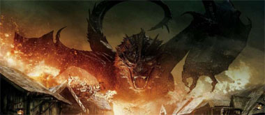 Poor, poor Martin Freeman: you can practically taste his desperation. I don't know how many hours he has sat in prosthetics in a field in the middle of nowhere, but every second is etched into his deep, querulous eyes. Is there a place beyond woe? Tolkien is the man who would know. Freeman has been in that place for five years, a moody, murky swamp of goblins and no more than three emotions, trying to affect surprise when someone screeches: "The eagles are coming!" By the end, he has given up even looking for eagles, half glancing at the sky with a hooded and distant stare, wondering, no doubt, how many people will ask him whether he and Cumberbatch are a couple or not during this publicity tour. ("Me and Benedict are not a couple, and Amanda is not my beard," he clarified last week; Amanda is his wife.) He seems almost relieved to be such a side note in this film, which focuses on, yes, a single enormous battle that takes up a mere 20 pages of the book, but is leeched out over an impressive 144 minutes here, involving... how many armies? I counted seven, 10 and four: men and elves and dwarves against absolutely everyone else — war bats and goblin hordes and great rock crunchers swinging bits of metal. If there is one thing I will miss from the films of Peter Jackson, it's the sight of a truly hideous giant in a tiny leather thong. He really gives great monster. Also: great raven, great beak, ridiculous non-scenes with Galadriel (Gate Blanchett), silly speeches beginning "a fire in the east", gloves, stupid hats and awful attempts at humour. Actually, I won't miss those. As a director, he may be able to realise a full-scale medieval battle featuring 9,000 10ft ores and Billy Connolly as a foul-mouthed dwarf astride a tacked-up war pig — the film's finest cameo, pitifully short — but he simply cannot do laughs. He lacks the right sort of prance, inventing a lumpy character in the shape of Alfrid Lickspittle (Ryan Gage) to provide sub-Carry On relief. Lickspittle ruptures the tone and spirit of Tolkien's world. 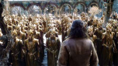 His books are at heart self important and humourless. There is no room for fake bosoms and cross-dressing — or, at least, none that anyone will admit. (This film is essentially a dance off between five troupes of warriors with long hair and/or plaits who have been scrapping over a pile of diamonds.) And what would Tolkien have made of the films? What would he have made of the man who has twisted and pounded his work to (mostly) such great effect? I like to imagine he would have spent most of his time running away from him, hissing: "Who's that bloody man? Why does he keep on wanting to talk to me? I can't remember why I called him Azog." If Jackson's two trilogies have taught us anything, it's that he is a rabid, obsessive, slavering fan. The films are our most epic example of fan fiction yet. But Kate Muir writing in the Times is more upbeat: “One film to end them all. Peter Jackson’s farewell to hobbits and Middle-earth is all killer battle scenes and no filler”: After 17 hours in Middle-earth, director Peter Jackson brings his six-film Tolkien epic to a climax with The Hobbit: The Battle of the Five Armies. During the swansong, dwarfs, elves, trolls, wargs, ores, eagles, bats and ordinary folk lay into each other with sword, catapult and stone in a stunning 45-minute CGI battle that can only be described as wargasm. Yet amid the clashing steel there are also clashing personalities, and the human, hobbit, elven and dwarfish drama is given space, building confidently on the seeds sown in the previous Hobbit films. Martin Freeman, as the eternally anxious Bilbo Baggins, and Ian McKellen as Gandalf, are almost upstaged by the growing theatrical and political power of the dwarf King under the Mountain, Thorin Oakenshield, played by Richard Armitage, and Bard the Bowman, played by Luke Evans. While taking Tolkien seriously, Jackson also allows himself comic outtakes, the greatest being Billy Connolly in a red fright wig, riding a giant hairy pig down a mountain as dwarf General Dain Underfoot of the Iron Hills. Unlike the first two fantasies, The Battle of the Five Armies has no sluggish downtime, perhaps because Jackson and his co-writers, including Guillermo del Toro, have largely freed themselves from Tolkien's 289- page 1937 book and gussied up the appendices for their own amusement. The battle merits but a few paragraphs in the text, but here it unfurls in sweeping aerial views like a Warhammer version of Akira Kurosawa's Ran. It's a visual success, except when Jackson gets carried away with CGI beyond the bounds of gravity and possibility. The film opens with a bumptious Stephen Fry as the Master of Laketown, desperately gathering his municipal treasure before Smaug the dragon (Benedict Cumberbatch) comes in to strafe the rooftops with his halitotic fiery breath. Smaug's voice reverberates through the cinema seats, patronising and patrician. The heroic and handsome Bard becomes a major figure in the story, as his takedown of the dragon, with what looks like a large poker, leads to a Black Friday-style rush by men, dwarfs and elves on the gold and treasure in the mountain of Erebor. Everyone wants a share and Tolkien's magic takes a back seat for a moment to Jackson's critique of capitalism. Meanwhile, inside the bling-crusted cathedral halls of the mountain, Oakenshield becomes crazed by the "dragon-sickness", an ugly greed that pervades the place. It gets positively Shakespearean — Armitage's psychological torment takes centre stage as he hungers after the powerful Arkenstone (one of those weird Tolkien objects that eventually results in self-destruction, like the ring). Amid the gold rush, morality, decency, and Baggins are almost sidelined, but as usual Freeman makes every hobbity sniff and grimace count, and he always has that creepy-but useful ring in his pockets, just in case. Rarely has a citizen of Bag End looked so worried and rightly so, because as Gandalf points out, the ores are coming, powered by Sauron's evil. Cut to the plug-ugly ore leaders, Azog and Bolg, plotting their attack with those amusing ore-language subtitles. Actually, if, like me, your children have forced you to watch Lord of the Rings and the Hobbit on DVD over and over for years, often re-enacting key sections, you'll find you actually speak fluent ore. And elf. This is a pretty blokey saga, although it's lovely to see the elves Legolas (Orlando Bloom, with freshly ironed hair) and the archer Tauriel (Evangeline Lilly), who provides some feisty relief, again. Aside from the participants, no one is keen on the interspecies romance between Tauriel and the dwarf Kili (Aidan Turner), but it may keep the less warlike elements of the audience engaged. 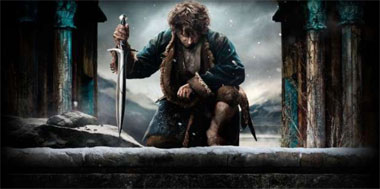 This is a satisfying end to an adventure that started in 2001 with The Return of the King, and a moment to admire the advances Jackson has made with green-screen CGI and " battle choreography. For me, the films and books have been part of my (now grown) sons' lives, like the previous Harry Potter series, and I'm sad — and also a little relieved — to see them end. The film's final shot, of the map frontispiece of the original book, took me back to first reading The Hobbit aged 12, in the days before Middle-earth conquered the world through Jackson's imagination. Why are our Historic Sites under threat? Ben Macintyre explains: History makes you happy. That is the verdict of a new study by English Heritage, which found that visiting heritage sites has a greater impact on personal wellbeing than other leisure activities, including sport. Nothing, it seems, lifts the spirits higher than a visit to a historic building. The Heritage Counts survey converted that conclusion into cash terms: the average visitor derives £l,646- worth of wellbeing from heritage sites every year, compared with just £993 for individuals engaged in sporting activities. (This is the amount of money you would have to take away from people to return them to the level of wellbeing they'd have had if they hadn't done these things.) This discovery is not just surprising but culture-changing: for decades, the government has been nagging that we would be happier and healthier if we got off the sofa have been telling us to visit Blenheim Palace, or Kew Gardens, or the old iron works. While consuming five portions of fruit and veg a day, we should also be gobbling up ancient buildings, perhaps not five a day, but five a month, or at a minimum five a year. (The average heritage fan currently visits 3.4 sites annually.) Britain has a profound sense of historical place. An affinity for our built past is sewn deep into the culture, in literature and landscape. The great buildings across the land provide not just happiness, employment and income, but "heft", that ancient and almost indefinable sense of belonging. Yet our built heritage is in peril, underfunded, and underappreciated by government and, in too many instances, crumbling. We derive vast pleasure and profit from our buildings and neglect them in way that is illogical, reckless and irreversible. Historians of the future may look back on the early 21st century as the time when we let our history fall down. Great English literature is jampacked with great buildings, for no country is so attuned to the symbolism of bricks and mortar. Mansfield Park, Blandings Castle, 221B Baker Street, Marlinspike Hall and Downton Abbey. All are invented; all are derived from real places. Castle Howard is in the news, ostensibly because of a change in its administration but in reality because it is "Brideshead" from the television adaptation of Evelyn Waugh's novel, a building visited by 200,000 people a year but repeatedly revisited in the imaginations of millions more. Our veneration for stately homes is not mere snobbery or escapism, but a very British form of historical pilgrimage. The heritage sector contributes more than £20 billion to the UK economy. Some 13 million visitors a year pour into the 1,500 privately owned houses and gardens of the Historic Houses Association; membership of the National Trust and English Heritage continues to rise steadily. 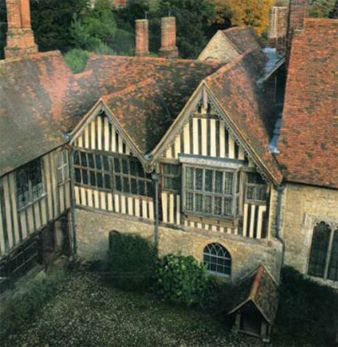 Our conception of what is worth preserving in the man-made past is also expanding: just as the everyday lives of our forebears now hold our interest more than great events, so do their homes and workplaces. We flock to see not just castles and palaces, but cottages, barns, foundries, pubs, prisons, burial mounds, battlefields and shipwrecks. Buildings, like humans, are in state of ineluctable decay; but unlike us, with proper maintenance they can be preserved for ever. They feed the mind, the exchequer, and the soul. We profess to revere them, and yet as a nation we neglect them atrociously, for the built fabric of Britain has never been more loved, or in greater peril. The latest Buildings at Risk Register, drawn up by English Heritage, include 1,115 important buildings in serious danger. Add churches, parks, gardens and monuments under threat, and the number rises to 5,750. More than 600 places have been added to the register in 2014; four in every ten of the buildings considered at risk in 1999, when the register was first drawn up, are still on it. The backlog of vital conservation projects is growing at an alarming rate, along with the "conservation deficit" — the funding gap between the cost of repairs and the end value of a building. This now stands at £443 million. Since so many buildings would cost more to mend than their final monetary worth, preservation is not an economic investment, but a moral imperative. The heritage sector was disproportionately walloped by the cuts imposed by the coalition, including a 32 per cent cut over four years to English Heritage. The number of historical-buildings conservation officers employed by councils has dropped by more than a third in eight years. To quote Shakin' Stevens, the balladeer of architectural renovation, this old house is getting shaky. If visiting historical sites makes us happier than sport, then perhaps we should treat our built heritage with the same obsession that we devote to sporting activities: regard it not as a weekend hobby but as a vital public benefit, train a new generation of participants, and encourage oligarchs to invest in heritage projects as status symbols. If Russian money can revitalise Chelsea FC, it might also restore Eastbourne pier. Like sport, the historical training programme should be gradual and cumulative: start with a few local sites, and slowly build up to a weekly stately home. This may be demanding to start with, but it will make you happier in the end. Breaking News Greenpeace apologises after stunt damages monuments ""Irreparable damage" to a large area of the Nazca lines, an ancient monument, during a publicity stunt, according to a Peruvian prosecutor investigating the incident. The damage is spread over an area of 1,600 square metres beside a stylised figure of a hummingbird etched into the desert soil, the prosecutor said. A spokeswoman for the public prosecutor said that, under Peruvian law, causing damage to a world heritage site could be punishable by a three to six year prison sentence. The Peruvian Culture ministry is also considering suing Greenpeace for damages. The group of at least 12 activists "dislodged rocks" and "left a white trail" while placing giant letters in the soil close to the figure of a hummingbird etched into the desert soil, according to the report by Javier Paredes, an archaeologist commissioned by the culture ministry to assess the damage. The report says that the group "altered the natural surface in the area in the form of path where they accessed the site and numerous footprints were left during the placing of the letters, which said: "Time for change! The future is renewable." 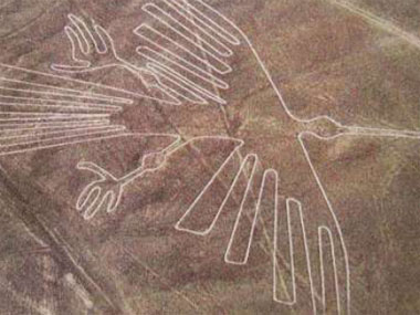 The report added: "These alterations are visible not only on the ground but from the air, altering the general configuration of the area." The Nazca lines are a set of giant images of plants and animals, such as a monkey, a spider and a hummingbird, excavated in the soil 1,500 years ago. Greenpeace initially tried to play down the incident but, when it realised the extent of Peru's anger, it issued an abject apology, admitting it had appeared "careless and crass". Kumi Naidoo, Greenpeace's global director, is flying to Peru to apologise to the government, which is hosting a UN conference on climate change. The statement said Greenpeace would fully co-operate with the investigation and was "willing to face fair and reasonable consequences". 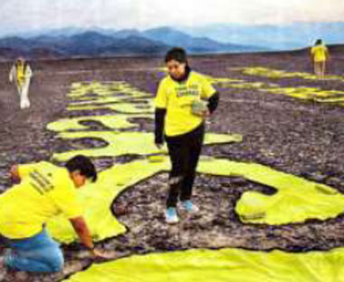 However, Greenpeace refused to say whether it would comply with a demand by the authorities for it to identify the activists who took part. Some of them are identifiable from photographs and video that Greenpeace had published before it realised the stunt had backfired disastrously. It declined to say who within its organisation had authorised the stunt. Dominik Fleitmann, professor of archaeology at the University of Reading, said: "Greenpeace may be raising an important issue but it looks like they have gone about it in the wrong way. The Nazca lines are the extraordinary but fragile remains of a former civilisation and should be treated with respect. "There is nothing wrong with peaceful protest, but those claiming to support conservation should be careful to practise what they preach." Green peace ordered its staff not to talk about the incident but one staff member said there was great anger inside the organisation that "stupid" activists had tarnished its reputation and undermine its work at the Lima climate conference. The staff member said the stunt was aimed at drawing attention to need of agreement at the climate talks but had the opposite effect, prompting debate about the arrogance of activists. The Peruvian government said it would try to prevent the activists from leaving the country. Mr Naidoo tweeted: "I am deeply concerned about the developments in Peru with regards to the sacred Nazca lines. I am on my way to Lima now to collect more information." Breaking News/2 Norman Hammond reports on the great hall uncovered at Silchester One of the largest prehistoric buildings ever erected in Britain has been uncovered at Silchester in Hampshire. More than 50m long and dating to the time of Christ, the great timber hall is thought to have been the headquarters of an Iron Age chieftain. "The building probably served as the dwelling of the 'big man' and his family, a focal point for feasting, and the assembly point for his supporters," Professor Michael Fulford said. "We believe it belonged to one of the leading men of the Atrebates tribe." Silchester's Roman name was Calleva Atrebatum, and the Roman city — in open fields near Basingstoke — was built on the site of a larger Iron Age community. Eighteen years of excavation by Professor Fulford's team at Reading University have peeled away centuries of archaeological deposits: finding the northern end of the hall and completing its plan was achieved just before the project finished. The hall is 8m wide, and oriented northeast to southwest, across the north-south grid of the subsequent Roman town. It is, however, completely contained within one of the city blocks or insulae, and evidence from previous seasons suggests that Iron Age domestic structures simply maintained their traditional orientations within the framework of the Roman plan. 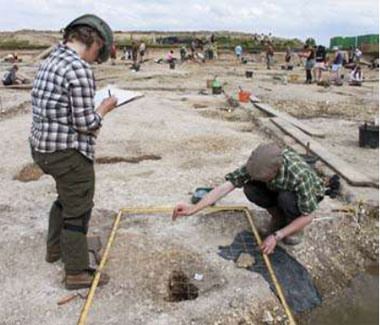 The long foundation trenches for the hall do not show whether it was constructed on a series of horizontal cill beams, posts or close-set planks. All three techniques are known from large prehistoric timber buildings elsewhere. The massive wooden frame would have supported a thatched roof, Professor Fulford believes, and the structure represents a considerable investment of labour and valuable materials, testimony to the high status of its occupant. Part of the hall was found several months ago (The Times, Jan 11, 2014), but its overall size remained unknown. The northern wall was uncovered this month, completing the plan. "The closest parallels are in the Netherlands, Belgium and northern France: on the continent these long halls are described as "housestables", and it is possible that our hall also housed domestic animals, although an annexe on the north might have done so," Professor Fulford said. Despite its size, the great hall was dismantled within a generation and replaced by a smaller, though still substantial, one within a fenced compound. "A striking feature of the Iron Age discoveries here is the steepness of the social pyramid," Professor Fulford said. "On the one hand there is this hall some 50m long, on the other there are dwellings and small buildings clustering around the edge of the compound, the homes of the chief's supporters." 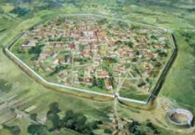 Iron Age rubbish pits are clustered around the remains of smaller dwellings surrounding the hall. The pits have yielded a rich haul of household debris; one of this year's finds has been a well, still in use when the Roman annexation of Calleva occurred in about AD44. The well contains not only waterlogged plant remains and seeds, which "will provide remarkable illumination on environment and diet in Calleva at the time of the invasion", but discarded pieces of Roman military equipment. Most evocative is the bronze folding handle for a skillet, a portable cooking pot that the Emperor Claudius's legionaries would have carried on their rapid march of conquest across England. It points, Professor Fulford said, "to a probably short-lived military occupation of Calleva after AD44". Then the civilian city was laid out, and the Atrebates settled down under new masters, but with much of their old way of life continuing. Mystery of the tiles with Nero’s stamp at Silchester- Norman Hammond continues the story: An impressive Neronian-period building has been found at Silchester, near Basingstoke. Marble fragments attest a lavish structure, but the key evidence consists of pottery tiles stamped with Nero's name. Their text — "Ner(o) Cl(audius) Cae(sar) Aug(ustus) Ger(manicus)" arranged on a stamp pressed into the clay before firing—is unequivocal: but what is striking about them is that such tiles have been found nowhere other than Silchester. Where these fragments came from is not certain, but a good candidate is the large building uncovered late this summer. Professor Michael Fulford, director of the Silchester Town Life Project, surmises that it may have been built for a British leader in the generation after the Roman conquest: the building may never have been completed, possibly because it was part of a Neronian development erased after his death. "Nero suffered a damnatio memoriae — an expunging of his name from all public monuments — so inscriptions and other remains are uncommon", Professor Fulford said. He also raises the question of whether, given that this mansion was built on Calleva's newly laid-out street grid, the plan was itself part of Nero's plans for the town. He thinks that it might have been to reward a local ruler – perhaps Cogidubnus — for support against Boudicca in AD 60- More investigations are planned for next summer, when the "mystery of the tiles" may be resolved. National Geographic Vol.226 No.3:82-110. Silchester Town Life Project Reports, University of Reading. Research News Aerial survey of Kent. Paul Wilkinson reports on a research project by the Kent Archaeological Field School ‘If you are studying the development of the landscape in an area, almost any air photograph is likely to contain a useful piece of information’ (Interpreting the Landscape from the Air, Mick Aston, 2002).  Students of the KAFS are starting a two year programme of collating Google Earth aerial photographs from 1940 to 2013 to enable focused information which can then be followed up by ground survey. The fruitfulness of this can be appreciated by the work of the field school along Watling Street in North Kent where hundreds of important archaeological sites have been identified. The ultimate aim is to publish the results online. Aerial photography is one of the most important remote sensing tools available to archaeologists. Other remote sensing devices that will be used are satellite imagery and geophysics. All of this information can be combined and processed through computers, and the methodology is known as Geographic Information Systems (GIS). The development of aerial photography goes hand-in-hand with the development of the aeroplane and camera. A 1907 photograph taken on a plate camera in a balloon floating above Stonehenge is one of our earliest aerial photographs, whilst in 2003 satellite imagery of the Iraq deserts revealed to American archaeologists hundreds of miles of buried roads from the earliest empires of that region. An early pioneer in aerial photography was O.G.S. Crawford. Funded by the marmalade millionaire, Alexander Keiller, Crawford photographed, from the air, archaeological sites in central southern England. The results were published in the classic book, Wessex from the Air (Crawford and Keiller, 1928). Crawford collected aerial photographs from as many sources as possible, but mainly from the RAF. Working prior to the massive destruction by the ploughing up of archaeological features in the landscape in the Second World War and after, the images revealed some remarkable features. Much of Crawford’s collection can still be seen in the NMRC in Swindon. During the Second World War there were huge advances in technology. Aerial reconnaissance, carried out by specialist units of air forces, benefited from these advances and produced first-class aerial photographs. 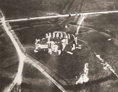 A number of archaeologists were involved in aerial photograph interpretation, and after the war an aerial photographic unit was founded by Keith St Joseph, which in 1949 became the Cambridge University Committee for Air Photography (now the Unit for Landscape Modelling). Its contribution over the last 60 years has been invaluable, with hundreds of sites located all over Britain. The Cambridge Collection is available for study and is important because an aerial photograph taken, say, 30 years ago will show features in the landscape that may have now been removed by modern farming. In 1967 The Royal Commission on the Historical Monuments of England (RCHME) organised a national aerial reconnaissance programme which entailed the collection of existing aerial photographs, the acquisition of the RAF’s historic collection of photographs, especially the 1946-8 series. The success of this policy can be seen in the growth of the collection from a few thousand to over 400,000 oblique and 2.4 million vertical aerial photographs all held at the NMR centre at Swindon. How to use aerial photographs Aerial photographs are merely raw data; they are a means to an end. The photograph needs to be examined so that the terrain can be interpreted and archaeological traces from features such as Roman roads, lost settlements, forts, villas, canals and old river beds located. Aerial photographs are of two main types; the oblique and the vertical. Each has its advantages and drawbacks. Oblique aerial photographs, taken at an angle to reveal contours and shadows, are best for discovering sites, whilst vertical photographs are more useful for mapping. However, it is possible, using appropriate computer software programmes and at least four known points on the ground, to map an area quite accurately from an oblique aerial photograph. Vertical photographs can be overlapped to give a three-dimensional effect through stereoscopic viewing lenses. Oblique photographs taken at low altitude are the most important means of discovering sites from the air because they provide perspective and a clearer view than vertical photographs. Also obliques are usually taken specifically for the purpose, whereas verticals are taken for general or planning purposes. more or less at right angles to the sun’s rays. If a bank or ditch runs parallel to the rays of light it will be difficult to see. It is essential to take aerial photographs at different times of the day and different times of the year to capture all of the site features to be seen, and a slight dusting of snow will also enhance features on the site. Shadow sites can also be seen and surveyed on the ground, but crop and soil marks can generally only be seen from the air. Crop mark sites are some of the best indicators of buried features on a site. The variation in height of the crop, colour and vigour of growth can help find features beneath the surface. Where the soil is damp, as in a buried ditch or pit, the vegetation will be taller, greener and more dense. This is a positive crop mark. But over a buried building the soil above the walls will be thinner, drier, and the vegetation will be sparser and not so lush. This is a negative crop mark. There are three main visible archaeological features to be identified from aerial photography: shadow sites, crop mark and soil mark sites. Shadow sites are usually the most visible archaeological features to be seen in the landscape. Any site with lumps and bumps like banks or ditches has the potential to show shadows. In the raking light of low sun, early or late in the day, the site can spring to life in fascinating detail. Shadows will only be cast. The greener, denser vegetation appears darker from the air and dark, almost black on existing black and white aerial photographs. Visibility of crop marks will change throughout the growing season, and indeed on a day-to-day basis. Different crops will react differently to soil building the soil above the walls will be thinner, drier, and the vegetation will be sparser and not so lush. This is a negative crop mark. The greener, denser vegetation appears darker from the air and dark, almost black on existing black and white aerial photographs. Visibility of crop marks will change throughout the growing season, and indeed on a day-to-day basis. Different crops will react differently to soil conditions, and in the years of drought, 1946, 1947, 1976 and 1984, hundreds of new sites were identified. It is worth noting that grass has to be really parched before any buried features become apparent. The most useful plants to produce crop marks are wheat, barley, peas, sugar beet, and maize. If a site is subject to crop rotation it will be most useful to take aerial photographs over a number of years. For the corn crops — wheat, barley, oats — it is worthwhile to keep an eye on the field, and as the crop turns from green to yellow to photograph it from the air. This will be the optimum time to discover crop marks. Soil marks are usually at their best in ploughed fields. Every feature on an archaeological site is likely to be made out of different soils. Colour and texture of the soil is the key indicator to the understanding of any archaeological site. Ditches may be in-filled with a dark silty soil; robbed wall foundations may show as streaks of grey lime mortar; ploughed-out barrows may show as a dark circle enclosing streaked re-deposited natural soil. Differences in moisture can reveal hidden ditches or even the walls of a buried building. After rain, the buried building’s walls will retain moisture longer than the surrounding soil and leave a damp mark. Conversely, after frost, the cold walls of a buried building will retain the frost over the buried walls longer than will the surrounding soil. These soil mark patterns may be extremely clear on a dry day or very blurred because of long-term ploughing of the site. Either way, they are a good indicator of the survival of the buried features as seen from the air. Google Earth image of an unknown archaeological site in Kent. KAFS BOOKING FORM You can download the KAFS booking form for all of our forthcoming courses directly from our website, or by clicking here KAFS MEMBERSHIP FORM You can download the KAFS membership form directly from our website, or by clicking here |
|||||
 If you would like to be removed from the KAFS mailing list please do so by |
||||||